Distance 9km
Elevation 400m
Duration 4h
Difficulty Difficult
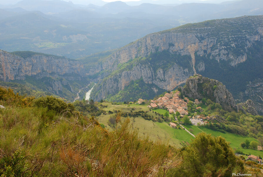
Perched at more than 1 m above sea level and overlooking the village of Rougon, the Suech plateau is a unique, wild site marked by pastoralism in real contrast to the popular routes of the Verdon Gorges.
Description
Departure from the top of the car park which is at the entrance to the village of Rougon.
Take the GR4 for about 2 km to the entrance to the Suech plateau. After 100 m, at the intersection, continue to the right along the GR which crosses the plateau. At the end of the crossing, turn left towards a small pass.
Just before the ruins of an old sheepfold, leave the GR and follow the path to the left towards Blieux (orange markings). After a short climb, the path splits, turn left and reach the end of the plateau.
Before the ruin of Peicard, follow the path on the left along the Barre de la Grau (yellow markings). 50m from the edge, follow the path among the boxwoods to join the plateau path.
Return to the village by the track taken on the way there.
Details concerning animals : Please note, you are in a pastoral area, there may be protection dogs (patous): keep your dogs on a lead.
Type : Marked loop
Distance : 9km
Elevation : 400m
Duration : 4h
Difficulty : Difficult
Average altitude : 1171m
Max altitude : 1329m
Marking details
White/Red then Yellow then White/Red
Cartographic references
Map of 32 hiking trails around the Verdon Gorges, from La Palud-sur-Verdon to Castellane / Map of hiking trails in the Verdon Regional Natural Park