
Distance 14km
Elevation 557m
Duration 4:30
Difficulty Difficult
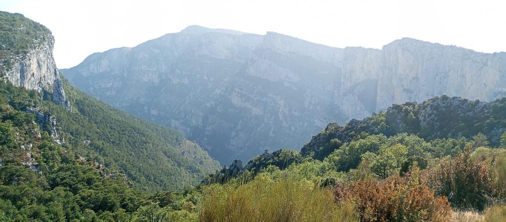
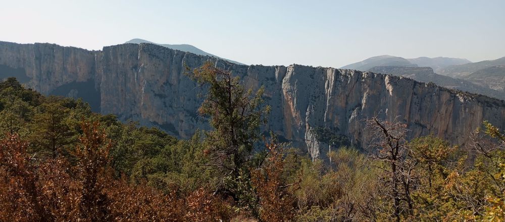
This pretty path, crossing the canyon, travels between two departments: it passes by the Tusset bridge and goes to the hamlet of Entreverges. You will pass through beautiful undergrowth worth a look in Autumn.
Description
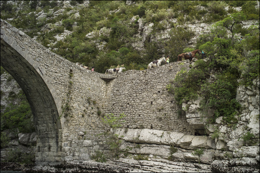
By going to the back of the Samson corridor car park (side opposite the road), you will find the Chemin du Pont de Tusset, which takes the GR 49. After a short but steep descent into the undergrowth, you will arrive at one of the most beautiful bridges spanning the Verdon: the Tusset bridge.
Then continue along the GR49 path, be careful, the climb is steep and long! You are on an ancient road, which allowed you to connect Digne-les-Bains to Draguignan. After reaching the flat and a good half-hour of walking, you will reach the Entreverges valley, to then return by the same path.
Details concerning animals : Keep dogs on a leash and pick up their droppings.
Type : Marked round trip
Distance : 14km
Elevation : 557m
Duration 4h30
Difficulty : Difficult
Max altitude : 1094m
Marking details
White Red
Delicate passages
Descent and ascent on the Pont de Tusset, quite steep and rolling (stoned).
Cartographic references
Map of 32 hiking trails around the Verdon Gorges, from La Palud-sur-Verdon to Castellane; Map of hiking trails in the Verdon Regional Natural Park