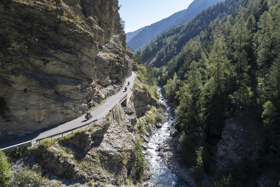
Crossing the Mercantour National Park, the Col de la Cayolle reveals gorges, waterfalls and picturesque hamlets up to 2,326 m. Crossing forests and meadows, it is a privileged place to admire the Bachelard Gorges and the 1910 engineering structures.
Description
The Cayolle Pass, situated at an altitude of 2,326 meters, marks the border between the Alpes-Maritimes and Alpes-de-Haute-Provence departments. The Cayolle Pass connects the Ubaye Valley to the Var Valley.
The Col de la Cayolle is a mountain pass located at an altitude of 2,326 meters, east of Mont Pelat (3,051 m). It spans the watershed between the Alpes-Maritimes and Alpes-de-Haute-Provence departments. Open for six to seven months of the year, it allows travel between the Ubaye Valley to the north, via the Bachelard Valley, and the Var Valley to the south.
But the real appeal of the Cayolle Pass, far beyond its altitude, lies in the beauty of the mountains. The Cayolle Pass crosses the Mercantour National Park, and in addition to abundant wildlife, it boasts waterfalls, streams, and mountain lakes.
It is not cleared of snow from December to May and is then closed to all traffic.